
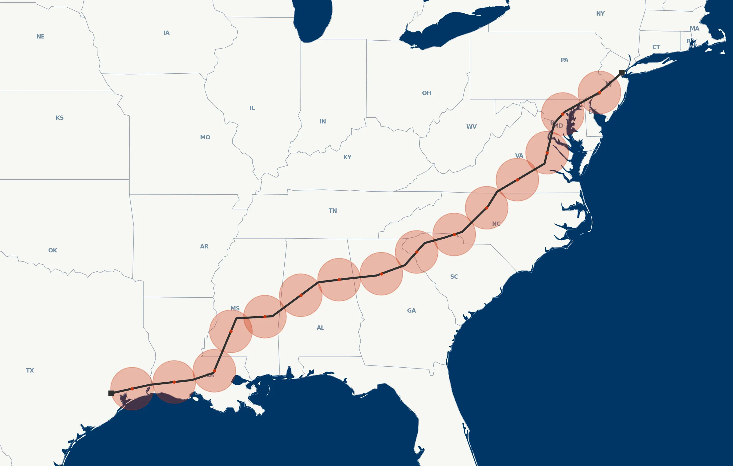
Pipeline corridors, imaged end-to-end by a networked Droneforce™ fleet.
100+ mile range, a methane-sensing payload, and a coordination layer that matches how your integrity program actually runs.
What manned patrols do. Without the pilot.
Linear inspection is a corridor problem, not an area one. A 100-mile range aligns with pipeline geometry — but payload is the real unlock.
A single airframe sweeping 100 miles of corridor per sortie, carrying the gas-detection stack a corridor inspection actually needs, without relocating ground crews. Today, that combination means a manned aircraft, complexity, and handoffs. A networked Droneforce™ fleet is flexible, integrated with your integrity-management systems, an extension of your field team, and autonomous on the cadence you set.
Methane detection on the revisit cadence operators need.
An audit-grade methane-detection payload on one airframe, on the revisit schedule your integrity program needs. Today, comparable sensor coverage means a manned aircraft, a flight crew, and a scheduling window — and revisit cadence stretches past what PHMSA would prefer. The Droneforce™ 55 closes that gap, without aircrew.
Operational, not transactional.
- vs. manned fixed-wing Routine revisit cadence, unmanned, no aircrew scheduling.
- vs. helicopters Same sensor quality, unmanned.
- vs. satellite methane monitoring Pinpoint source resolution, on-demand tasking, not weather-gated.
Multi-sensor pipeline data processed on-board and streamed live.
Data from a networked Droneforce™ fleet, integrated with the systems you already run — keyed to the assets you already manage, delivered into the tools your operations team already uses.
Geo-referenced methane, thermal, RGB, and LiDAR data — AI/ML-processed on-board for real-time feature detection, streamed via Droneforce One’s API into the GIS, integrity-management, and reporting workflows your operations team already uses. Timestamped and geolocated for ingest by operator-standard analytics platforms; segment-level tagging available via integration with your pipeline-referencing system.
Looking for one pipeline-integrity launch partner.
Oil, gas, or utility rights-of-way requiring persistent BVLOS corridor inspection and automated anomaly reporting. Partners get front-of-line access to the first operational aircraft, direct influence over mission profiles, and the reference-case position as we expand.
Think your operation fits?
Short application. Discovery conversation. If it’s a fit, you’re on the manifest.
AUVSI XPONENTIAL · Detroit · May 2026
Tell us what you need to fly.
Operators, integrators, investors, and DoD program officers route through different inboxes. Choose your lane and we’ll respond within one business day.
